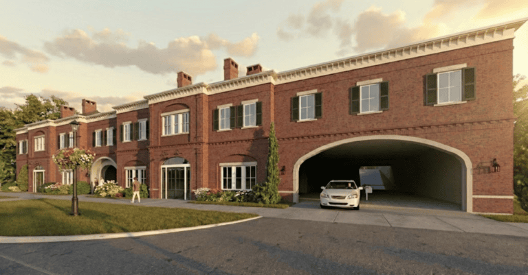

During the Dec. 2 committee of the whole planning meeting, council visited official plan and zoning amendments which would facilitate the construction of an apartment building at 1839 Four Mile Creek Rd.
Concerns were raised regarding this application.
Regarding stormwater management, Coun. Sandra O’Connor pointed out that the application proposes to utilize the existing infrastructure’s 15 per cent safety buffer in order to manage their outflows.
Note that most of our existing infrastructure is sized to a five-year peak storm event — leaving them already undersized (including the current 15 per cent safety buffer) to manage a 100-year storm event; a phenomenon that, with climate change, seems to be occurring almost annually.
It seems odd that there were no further comments or questions from the members of council regarding this issue; however, given this council’s record of supporting development proposals in the absence of robust professional engineering reports that encompass a complete analysis of impacts on existing storm/wastewater management infrastructure, this is, unfortunately, no surprise.
Ask the folks living in St. Davids who annually experience extensive flooding of their properties due to inadequate infrastructure and are watching the willy-nilly approval of new housing developments that will, almost certainly, add to their misery.
Or, speak to the third party engineering and groundwater management experts who have analyzed the sadly deficient engineering reports submitted to the town pursuant to the Parliament Oak hotel development.
Returning to this application, apparently most of our councillors have not travelled East & West Line between Concessions 4 and 6 during the heavy spring rains to witness the flooding of farmlands that already occurs — something this overture will likely exacerbate during peak storm events.
Moving on, O’Connor raised a question concerning the density of the proposed building.
In NOTL, we have only two density classifications: low density, at a maximum of 14 units per hectare and medium density, at a maximum of 30 units per hectare.
Historically, these parameters were established to ensure that any future developments would be minimally intrusive and compatible with established streetscapes.
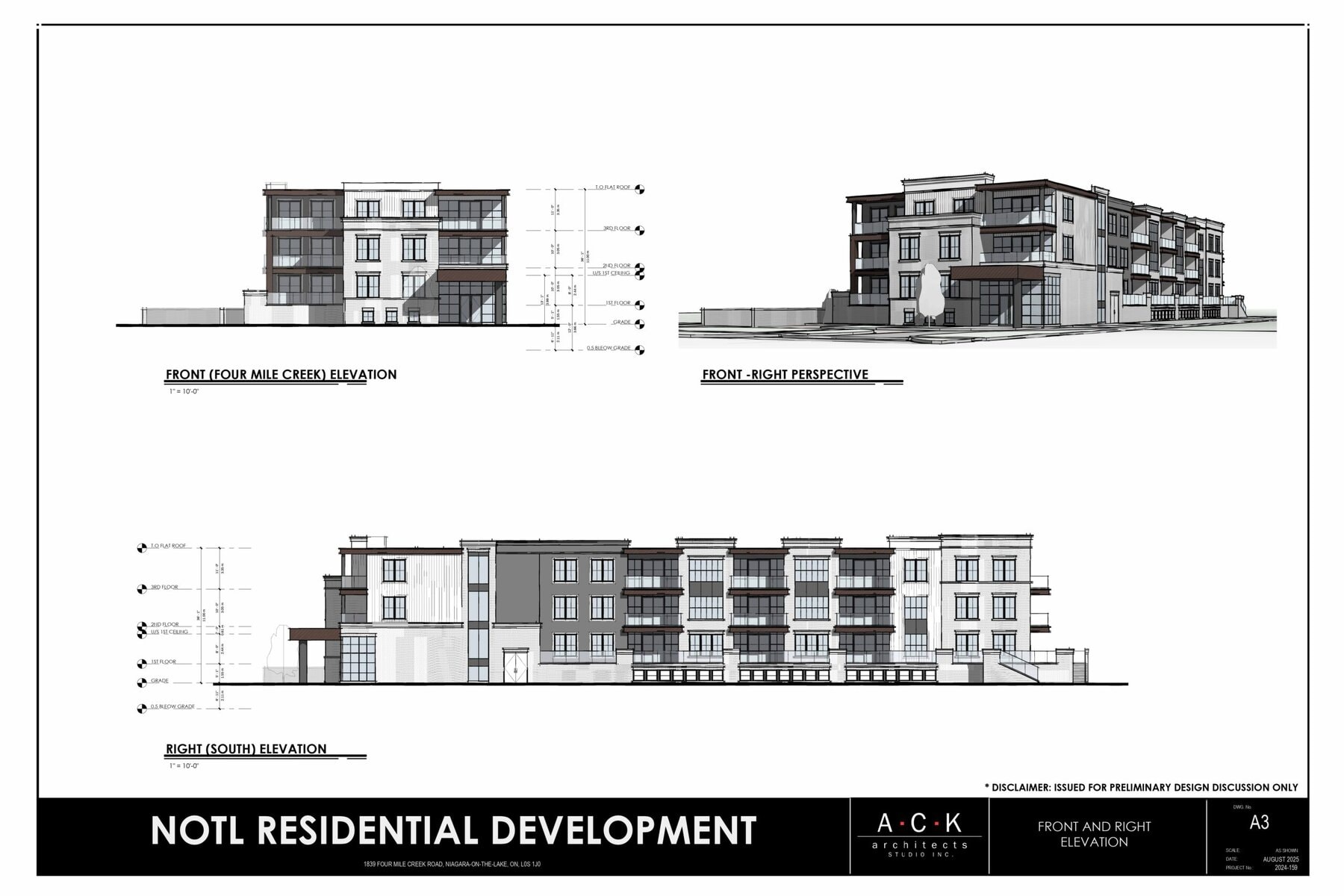
But, on the 1839 Four Mile Creek Rd. property, the proponent has offered an application based on 95 units per hectare — more than three times NOTL’s maximum density.
Coun. Wendy Cheropita opined that this would be classified as high density, but Coun. Andrew Niven put the question of its classification to staff.
In a “shake your head” moment, the town’s manager of development and planning, Aimee Alderman answered, “Our current official plan only has low-density residential or medium-density residential. We don’t have a high-density residential category. So, anything that is exceeding medium-density residential would still be considered within that (category), albeit with a different density.”
Across Ontario, anything above 60 units per hectare is honestly classified as high density. But, in NOTL, we disingenuously expand the medium-density category limit by 300 per cent to facilitate a development application.
Also raised by O’Connor was the absence of the regional urban design manager’s comments associated with the suitability of the proposed building in the context of the streetscape within the report/recommendation authored by town staff.
Mr. Khaldoon Ahmad wrote, “From an urban design perspective, the supporting urban design brief and architectural design do not sufficiently lay out a compelling rationale for why a low-rise apartment block represents an optimal urban design solution for this site.”
He continued: “The proposal is not put in contrast with other forms such as detached houses on a common element driveway, townhouses and stacked towns. Without an urban design assessment and or analysis of the proposed form in relation to surrounding buildings and other logical building options, the potential for establishing why this proposal represents good planning is not available.”
Further, he wrote: “The proposed development is in contrast to its surroundings in manifold ways. These should be addressed holistically with a sound architectural approach to justify the proposed zoning amendments. The proposed architectural approach — as a demonstration of an outcome of applying the proposed zoning — is more appropriate to an urban setting such as the core of Virgil or the Old Town.”
These comments largely echo my observations in the July 11 column (“Arch-i-text: What makes these two development proposals different”).
In part, Mr. Ahmad’s statements also speak to the question raised by Lord Mayor Gary Zalepa — who declared himself strongly in favour of the application — and subsequently repeated by the deputy lord mayor, Coun. Erwin Wiens: “If not here, then where?”
May I respectfully suggest that answering this question lies completely within their mandate.
In fact, the basic precepts of good urban development planning place the onus on the local government to proactively identify low, medium and high-density locations, then apply the appropriate zoning and manage the build-out according to best practices (see: Niagara Region’s model urban design guidelines ).
However, that would require taking responsibility for the solution and following best practices, rather than dancing to the tune of moneyed developers — a dance which, based on their voting record, this council is well versed in.
Brian Marshall is a NOTL realtor, author and expert consultant on architectural design, restoration and heritage.