Should context, character and history be considered when creating a new subdivision?
Experts on behalf of Save Our Randwood Estate (SORE) argued an enthusiastic yes during a virtual open house on June 9 regarding a proposed subdivision development on the Randwood Estate, now owned by Solmar Development Corp.
A revised site plan was submitted in March 2022 by Solmar.
That plan reduces the number of dwellings overall to 172 from 191, and addresses grading concerns by removing an underwater storm management system and replacing it with a storm pond. It also includes more green space.
The breakdown of housing types has been changed as well. Formerly, Solmar proposed to build 125 single-detached dwellings and 66 semi-detached homes. Now the company proposes 39 single-detached, 26 semis and 107 townhouses.
Paul Lowes, a planner with SGL Planning and Design Inc. and was representing Solmar at the meeting, said, among other points, that the proposal had been redesigned to meet the Region of Niagara’s request to feature a broader mix of housing types.
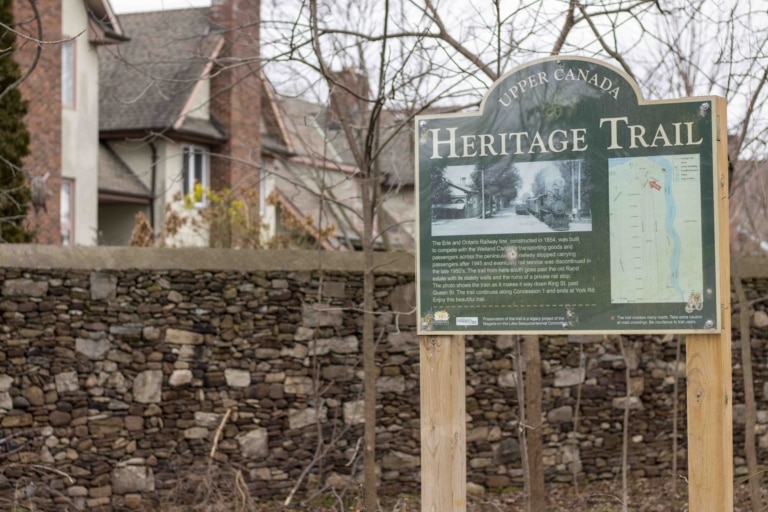
Green space has been increased and includes a heritage park, the Whistle Stop Trail Head Parkette, the Whistle Stop Trail and a community garden.
The garden will be a “big gathering space and community space for community events for the local neighbourhood and will be a walkway out to Charlotte Street,” said Lowes.
It will also double as an emergency vehicle access point, since there is only one proposed road into the subdivision. This came up multiple times during the meeting.
Landscape architect and University of Guelph Prof. Brendan Stewart started off his comments “by acknowledging that I’m not opposed to development happening on the sites in principle,” referring to the two properties targeted for development by Solmar, 200 John St. and 588 Charlotte St.
“I think it’s quite possible to develop a balanced and sensitive approach where the significant heritage and other resources on the property can be conserved while accommodating new development.”
“That new development could in fact be quite special as a result, being kind of informed by what’s really special here and creating new opportunities for the wider public to experience the unique history and attributes of the site.”
But Stewart felt the plans shown so far have not adequately addressed the character of the neighbourhood nor the heritage deeply embedded across the Randwood Estate.
Stewart said this is evidenced by the fact the latest proposal does not include an updated or amended heritage impact study.
A heritage impact study “is a very important document, in my view, in the process of heritage conservation,” he said.
The study would lay out significant historical features, explain why they are significant and how the development will address and conserve them as it progresses, Stewart said.
This process allows creativity on the part of the developer to incorporate character and heritage into designs and should not be forgotten, he said.
“They really help demonstrate that sort of due diligence has been done and that heritage conservation has been taken really seriously.”
He pointed particularly to the use of a road from John Street through the Rand Estate to reach the new subdivision. This road would pass directly through historic Dunington-Grubb designed gardens.
“I worry that that would have a pretty significant impact and it hasn’t been looked at carefully.”
Stewart, while admitting he is a landscape architect and not a building architect, expressed concern that the new proposal would involve the demolition of the carriage house and the Calvin Rand summer house at 200 John St., as well as the main dwelling and shed on Charlotte Street.
“And there’s no discussion of this,” he said.
Dana Anderson of MHBC Planning had five key issues with the proposal.
She first responded to Lowes’ statement the housing mix was based on the region’s comments, which she also related to intensification on the site.
While overall targets set by the region for the entirety of NOTL’s housing mix and intensification are important, local context and character must be equally considered, she said.
“Local context is really the key, a key planning principle for determining how and where growth and various housing types should be accommodated,” Anderson said.
“That does not appear to be the priority consideration for the plan.”
She also took issue with the proposed green spaces in the development, which are located on the edges of the subdivision to act as a buffer between neighbouring residences and the new buildings.
“That dispersion around the perimeter really doesn’t represent walkability or connectivity as suggested but really acts as spots for resting at the edges of the subdivision.”
The fact that there is only one access road for the development is unorthodox, as most municipalities require developments of more than 100 houses to have two access roads, she said.
The emergency access road that cuts through a trail and the proposed community garden creates safety concerns, Anderson said.
She also disagreed with the justification for the density of the project, which was that it is comparable to other infill developments in town.
“Stating that the proposed development is similar to density and other infill developments in other locations in the area and the built-up area, in our opinion, doesn’t equate to achieving the character of the existing Old Town,” she said.
“It does, however, need to be respectful of the character of the area’s context to limit the impact.”
She quoted the town’s existing official plan, which states intensification needs to be designated in built-up areas where it will not impact designated heritage areas, adjacent heritage resources and or heritage resources on the property.
“The proposal continues, in our opinion, to be a stark contrast in terms of lot pattern, density and … the road interface and heritage conservation.”
It’s not a “compatible fit” with the area, she said.
She pushed for the town to undertake a more comprehensive study of the Rand Estate than has been done previously, saying the town does not need to wait for its new official plan to be approved to do so.
The Rand Estate is targeted for a study in the unapproved official plan.
Jack Richard, a professional forester with Natural Resource Solutions Inc., spoke on behalf of SORE, expressing concerns with the development’s impact on the environment.
Of particular concern was the proposed complete removal of a wetland, half of which is on the Greenbelt and is considered a key hydrologic feature under governing policy, Richard said.
“The proponent accurately identifies that the (Niagara Peninsula Conservation Authority) policy document states that wetland removal may be permitted where it is demonstrated that no reasonable alternative exists,” he said.
“We don’t really feel as though no reasonable alternative exists to the wetland removal, particularly considering the previous development concept actually proposed to maintain a large part of that feature.”
He also questioned why the wetland is not being given a 30-metre buffer zone, as is required under the policies of the Greenbelt plan, he said.
Richard also criticized the development’s plan to remove trees that were determined as good habitats for endangered species of bats and suggested the developer check with the Ministry of Environment, Conservation and Parks about the legality of such a move.
One of the most concerning aspects of the plan is the removal of 21 trees that are each more than 100 years old, he said.
Richard pointed out what he saw as some confusing aspects of the site plan. In the drawings, a 125-year-old oak tree overlaps with a building and is proposed for removal. But two other oak trees of the same age also overlap with a building and are not slated for removal.
“There is some concern as to the level of accuracy of whether those trees can be retained.”
The lack of new studies with the developer’s updated submission was a recurrent theme.
Chris Stogios, a transportation engineer, said no new traffic study was submitted with the revised plan.
“As a result, many of our previous comments that we had noted on the site traffic impacts remain unaddressed,” Stogios said.
His main concerns revolved around traffic counts being done at poor times of the year and failing to present a comprehensive picture, traffic management along John Street and the proposed emergency entrance, which Anderson also addressed.
He said there is no data that proves fire trucks and emergency vehicles would even be able to use the access.
If that is the case, there is only one vehicle entrance to the development. If that should for some reason be impassable, there would be no way for emergency vehicles to get in.
“A revised traffic impact study should be completed to address these issues,” he said.
Ron Sheckenberger, an engineer from Wood Canada, said more due diligence is needed in the design of the stormwater management pond.
“Two factors — the lack of a system-wide basis of analyzing and sizing the stormwater management facility and an underestimate of the amount of impervious or hard surface cover — combine to likely make the stormwater management facility undersized,” said Sheckenberger.
Numerous residents spoke, addressing concerns about how the bordering trees would be handled, noise from the sewage pump, and simply declaring they think the entire proposal is an example of poor planning.


