
Document suggests downtown street redesign to better accommodate pedestrians and cyclists
Niagara-on-the-Lake’s proposed transportation master plan provides a sweeping overview of pedestrian and vehicular needs in town.
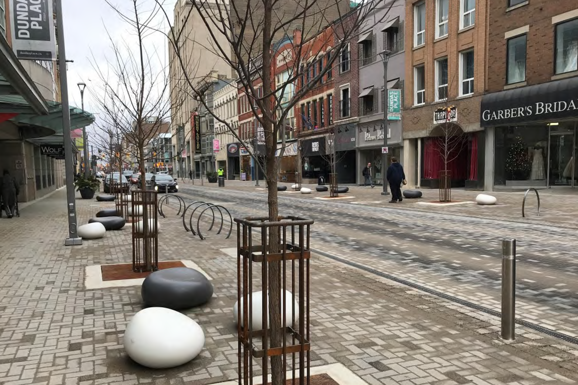
It also includes a recommendation to turn Queen Street within the Queen-Picton heritage conservation district into a “flex” street.
The town is seeking community feedback on the plan all this month. The document can be found and feedback submitted on the town’s Join the Conversation page.
Once the public comment period closes on Aug. 1 the plan will go to town council for final approval, likely on Aug. 22.
The Lake Report has put together a breakdown of some of the significant recommendations in the plan as they pertain to specific areas of town. At more than 170 pages, the plan contains far more details that can be covered here.
The plan as it stands would cost about $35 million for the town and $28 million for the region to implement, with work being completed over the next 10 or more years.
OLD TOWN
Written by engineering firm Stantec Inc., the report recommends changing Queen Street into a flex street to accommodate multiple modes of transportation.
That ties into one of the overarching themes of the report, which is to reduce “reliance upon any single mode (of transportation) and promote walking, cycling, transit, and other forms of transportation that are alternatives to personal vehicles,” the plan says.
“It is recommended that Queen Street be converted into a flex street, with a single grade or surface shared by people using all modes of travel at slow speeds.”
That would reduce pedestrian/vehicle incidents and near-misses and improve traffic flow throughout Old Town, it says.
The flex street idea would demand significant changes to the streetscape of Queen Street.
“In flex streets, curbs are removed and the sidewalk is blended with the roadway. Speeds are slow enough to allow for pedestrians to intermingle with bicycles, motor vehicles and transit.”
“It is also envisioned that the aesthetic of the flex street will be in alignment with that of the heritage district.”
One reason to turn Queen Street into an adaptable, multi-mode transport street is to discourage cars from using the area.
In tandem with directional signs to help visitors know where amenities, parking lots and historic sites are located, the flex street could cause traffic to “be naturally diverted away from Queen St. and towards parking lots and other street parking.”
The report notes that more cars could then use the “under-capacity side streets” that surround the Queen-Picton area, and it encourages more use of periphery parking lots around Old Town.
It also recommends reducing speeds on Queen Street to 30 km/h. If that is not possible, a reduced speed should be considered during peak tourist seasons and during events, it reads.
All of these suggestions work toward making Queen Street a safer area for pedestrians and cyclists to use, according to the report, which notes the municipality has approved the region’s Vision Zero plan to reduce traffic fatalities.
Further addressing the safety of pedestrians on Queen Street, the master plan recommends the installation of crosswalks, all-way stops and even an extension of the clocktower island in the historic district.
Extending the clocktower island could also deter business vehicles from parking in the centre of Queen Street, the document says.
The report says the town needs a strategy for moving goods into downtown so businesses can get deliveries without trucks parking in the middle of Queen Street.
The plan also addresses the horse-drawn carriage operations at Queen and King streets.
Several caleche operations have been shut down in recent years, in cities like Montreal and Philadelphia, it notes.
The plan recommends the town “inspect the caleche operations to ensure the horses are treated appropriately” and says “any complaints that may arise related to animal welfare should be taken seriously.”
The report recommends the caleche stand be moved to the Market Street parking lot to improve traffic flow along King Street. However, town council recently approved year-long licences for the carriage operators to occupy the land on King Street beside the Prince of Wales.
ST. DAVIDS
The master plan looks at two aspects of transportation in St. Davids – pedestrian needs and the intersection of York and Four Mile Creek roads.
The report recommends more sidewalks there and notes the town already has asked the region to build more.
The controversial York and Four Mile Creek roundabout is also addressed.
“This intersection can be considered to be the geographical centre of St. Davids,” the report reads.
“It is recommended that the town in conjunction with the region monitor traffic volumes along York Road and Four Mile Creek Road and ensure that the roundabout, when implemented, brings the desired benefits.”
Tanbark Road and Line 8 Road “might in theory be used as a bypass of the York Road / Four Mile Creek Roadintersection, but should this be needed, significant upgrades would be needed,” the draft plan says.
GLENDALE
Glendale is one of the focal points of growth in NOTL.
As such, the master plan recommends more sidewalks to connect residential areas with the outlet mall and Niagara College.
Many of the roads in the Glendale area are provincially or regionally owned and the report says the municipality needs to keep open channels of communication with the region in order to handle growth.
New overpasses on the Queen Elizabeth Way, the diverging diamond interchange and the twinning of the Garden City Skyway should be focal points for the municipality as it determines how to handle Glendale’s growth, it says.
VIRGIL
The plan makes recommendations for a minor sidewalk extension in Virgil along Henry Street.
The plan notes the engineering firm had not received concerns regarding traffic around Crossroads Public School but still recommended the extension of the community safety zone to Line 2 Road on the north and Pierpoint Drive or Concession 6 Road to the south.
Extending the community safety zone to Concession 6 would connect it with St. Michael Catholic Elementary School.
It also recommends the creation of a community safety zone around the Pleasant Manor long-term care facility.
NIAGARA STONE ROAD
“The greatest transportation constraints” in town are on Niagara Stone Road, the report says.
It recommends upgrading Niagara Stone to a four-lane collector road between Airport Road and Concession 6.
While the report recommended alternatives such as a Virgil bypass to deal with congestion, it states the upgrades to Niagara Stone should be considered foremost and implemented before further action is taken, as those changes could greatly reduce congestion.
Roads that should be monitored for a Virgil bypass include Line 3 Road, East and West Line, Concession 2 Road, Niagara Street and Charlotte Street.
QUEENSTON
Few recommendations were made for Queenston, with the most substantial revolving around tour buses.
According to the master plan, Queenston, in particular River Frontage Road, has more traffic in the summer than the rest of the year.
Traffic is particularly heavy as tourists and tour buses are drawn to Whirlpool Jet Boat Tours.
However, “no actions are recommended to improve the road network in consideration of tour bus operations,” the report says.
“Although tour buses may be a source of irritation for Queenston residents, no concerns were noted with respect to traffic flow or safety, so road network updates would likely prove ineffective at addressing the issue.”