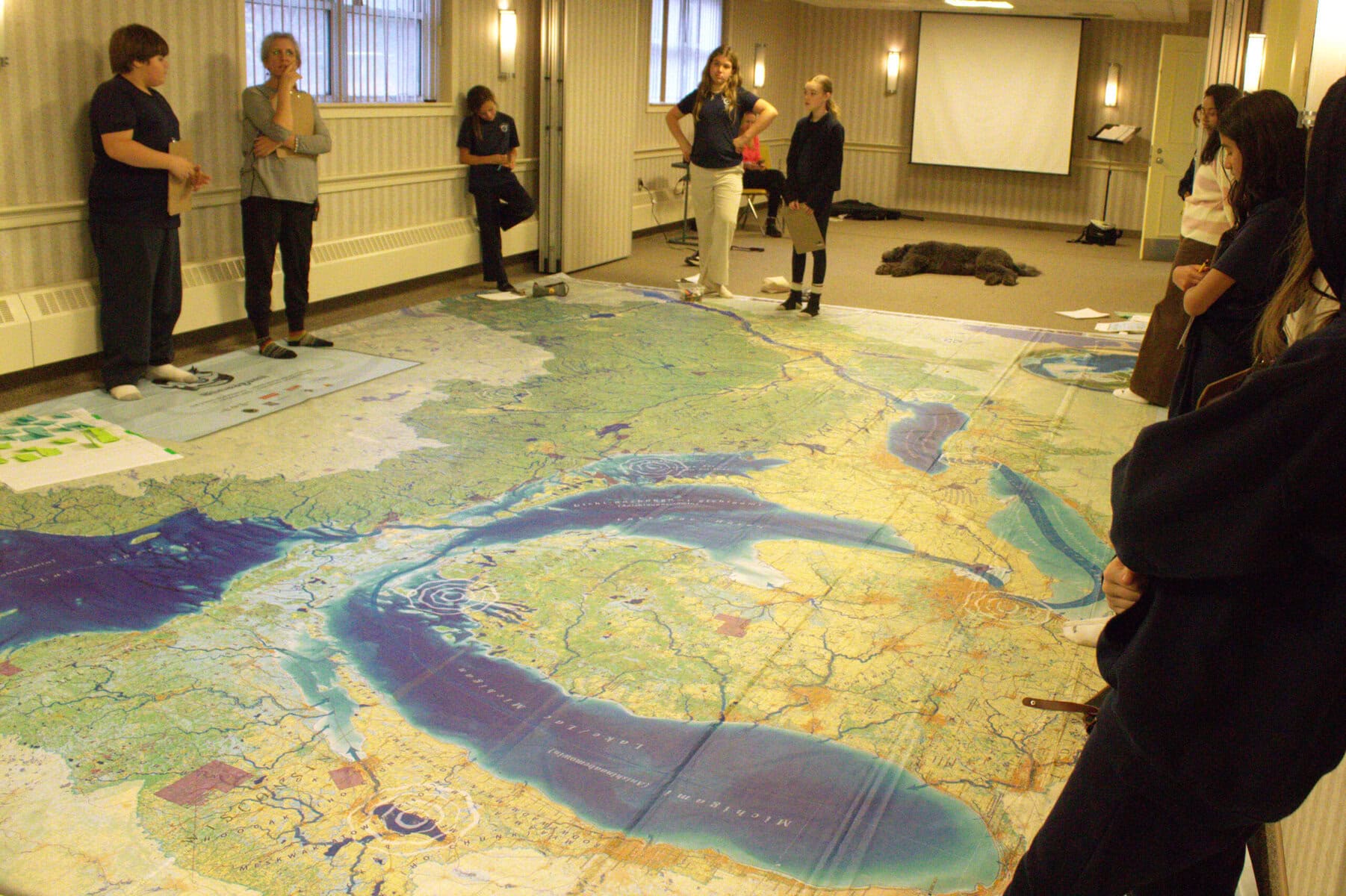

Royal Oak School principal Julia Murray is delighted to finally use Canadian Geographic’s Biinaagami giant floor map after waiting for “many years.”
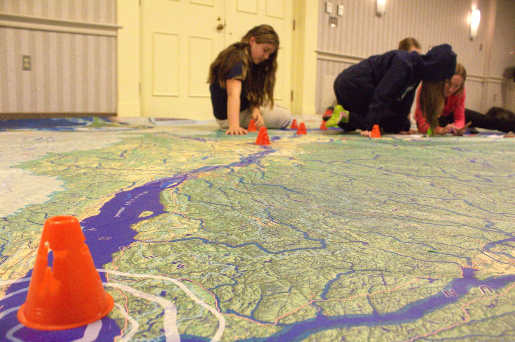
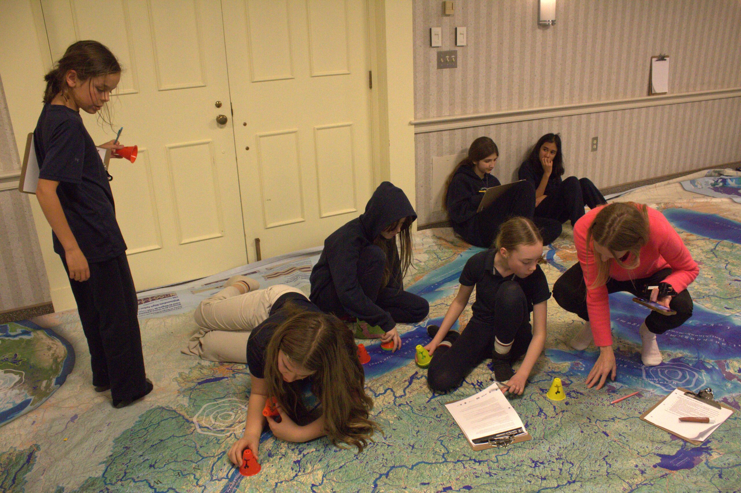
The 11-by-eight-metre map lets students take off their shoes and walk across a large-scale depiction of the Great Lakes and St. Lawrence River.
Biinaagami means “clean water” in Anishinaabe, Murray said. The name reflects the effort by Canadian Geographic and the school to draw attention to environmental issues in the region while grounding that work in Indigenous perspectives.
“This felt like a really good fit for our school,” Murray said. “Because of course, we are on the land of the Haudenosaunee and Anishinaabe peoples and the lake is a stone’s throw away.”
“How we keep biinaagami, or clean water, is deeply important to our way of life, to animals’ way of life, to Indigenous people’s way of life, and that we each have the ability to have an impact in creating a better system and environment around us.”
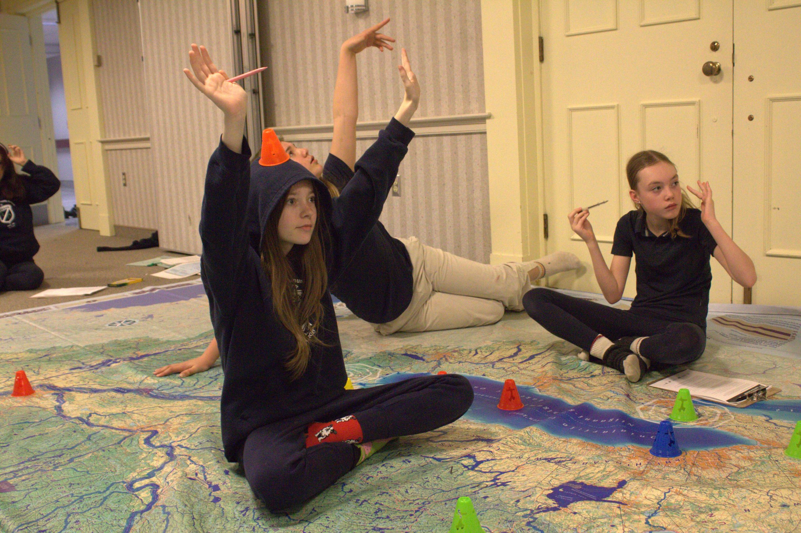
Teacher Melissa Smith brought grades 6 to 8 students to the map on Tuesday. They learned about the importance of the Great Lakes and the role water plays in sustaining life on Earth.
Students also personalized the lesson by placing small cones on five of their favourite places around the lakes. Many chose spots in and around Niagara-on-the-Lake, while others pointed out Philadelphia on the map or mentioned visits to areas near Lake Superior.
Austin Puffer, a Grade 8 student, said he saw a similar map before near Lake Superior. He called Tuesday’s lesson “fun” and was particularly excited that “we got to see big lakes.”
The map includes radio-wave symbols at 10 locations, where students can tap their phones to access virtual-reality videos. One shows beluga whales where the St. Lawrence River meets the Atlantic Ocean, highlighting their declining numbers.
Smith said the walkable, physical tour of local freshwater systems helps make those lessons memorable.
“This kind of resource would benefit every single kid,” she said. “Because I think there’s no way five years down the road these guys are asked ‘Oh, did you study the Great Lakes?’ and they would be like ‘No, I don’t remember.’”
Royal Oak School has the map for two and a half weeks total. They have it until Monday.