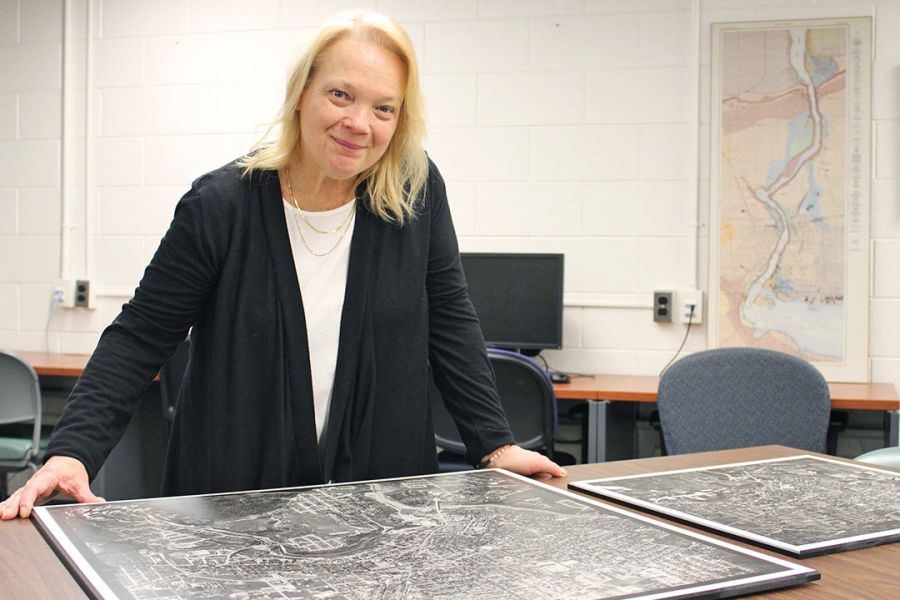

New maps showing lost routes along the Welland canals will be shown at Brock University on Tuesday and will be available to view online.
The maps shows 19th century Welland canal routes compared to today’s landscape, based on research by Brock’s head of Map, Data and GIS Library Colleen Beard.
Beard has spent the past eight years researching the Welland canals, said a Brock media release.
More recently, Beard created the Historic Welland Canals Mapping Project (HWCMP), an interactive web application that allows users to explore routes of the canals which are now mostly hidden.
Beard will present her research and stories of what it took to complete the project during a public talk called “Mapping the Historic Welland Canals One Lock at a Time — My Story.”
During her research, Beard hiked every metre of the three historic canals in St. Catharines and Thorold alongside local canal advocate Rene Ressler to document the landscape.
“Mapping the routes and features on the current landscape made me realize the vastness of these canals,” Beard said, in the release.
“Scaling wing walls, traversing lock walls and dodging wildlife is all very exciting, though it has an element of danger. Yet, it was necessary, in order to map every remnant of the canals that remains visible today.”
The research field, called Historical Geographic Information Systems, is characterized by the use of current mapping technologies applied to a historical subject
“It is a relatively new area of research,” Beard said, “but it’s becoming very popular with colleagues across Canada.”
In the early stages of the project, Beard and her team focused on digitizing historical maps and aerial photos and showcasing them using Google Earth.
She said comparing historical canal images to the current landscape reveals some “stunning contrasts.”
Beard said the digital map data created for the canals has already been used by architectural students for 3D modelling of the canals.
“The digital map data created for the canals has been used by architectural students for 3D modelling of the canals, as well as faculty for planning a local archaeology dig of a ship buried on the bank of Twelve Mile Creek at the old Shickluna Dry Dock site,” she said.
What: Colleen Beard presents “Mapping the Historic Welland Canals One Lock at a Time — My Story”
Where: Brock University, Mackenzie Chown C405
When: Tuesday, April 3 from noon to 2 p.m.